When researchers with Polar Bears International (then with the U.S. Geological Survey) began studying polar bear dens in Alaska in the 1980s, the only method they had to find snow dens was if someone happened to see a pregnant female digging one—which was pretty rare given the remote nature of Alaska’s North Slope. But as more industry began moving into the North, it became clear that being able to find and map polar bear dens was important to help shield moms and cubs from disturbances.

We caught up with Geoff York, our senior director of conservation, and BJ Kirschhoffer, our director of field operations, to learn more about Polar Bears International’s efforts to develop a promising new tool—synthetic aperture radar, or SAR—to detect dens hidden under the snow, with a goal of protecting denning polar bear families. 

Q: Let’s start with a little background information. The first technology used to detect polar bear dens was forward-looking infrared (FLIR). This tool is still in use but has real shortcomings. Can you tell us more about FLIR and why a better method is needed?

A: Geoff York: During fieldwork in Alaska when we were first working on the den-detection problem, we researched using FLIR, which had been tested for a variety of uses with wildlife. Through our research, we quickly discovered that FLIR could be a useful den-detection tool if conducted under strict protocols and very specific weather conditions and terrain. But it proved unsuitable for large-scale surveys due to those limitations.

Over time, as we watched FLIR in use by management and industry, we noted many additional shortcomings. We found that, in practice, FLIR missed 55 percent of all dens known to be within survey areas, an unacceptably high rate. 

These shortcomings mandated that we explore other ways to avoid disturbing denning families, so we started looking at newer technologies in partnership with Dr. Tom Smith and his students at Brigham Young University. The most promising alternative is SAR, and we’re now testing whether it can live up to its potential.
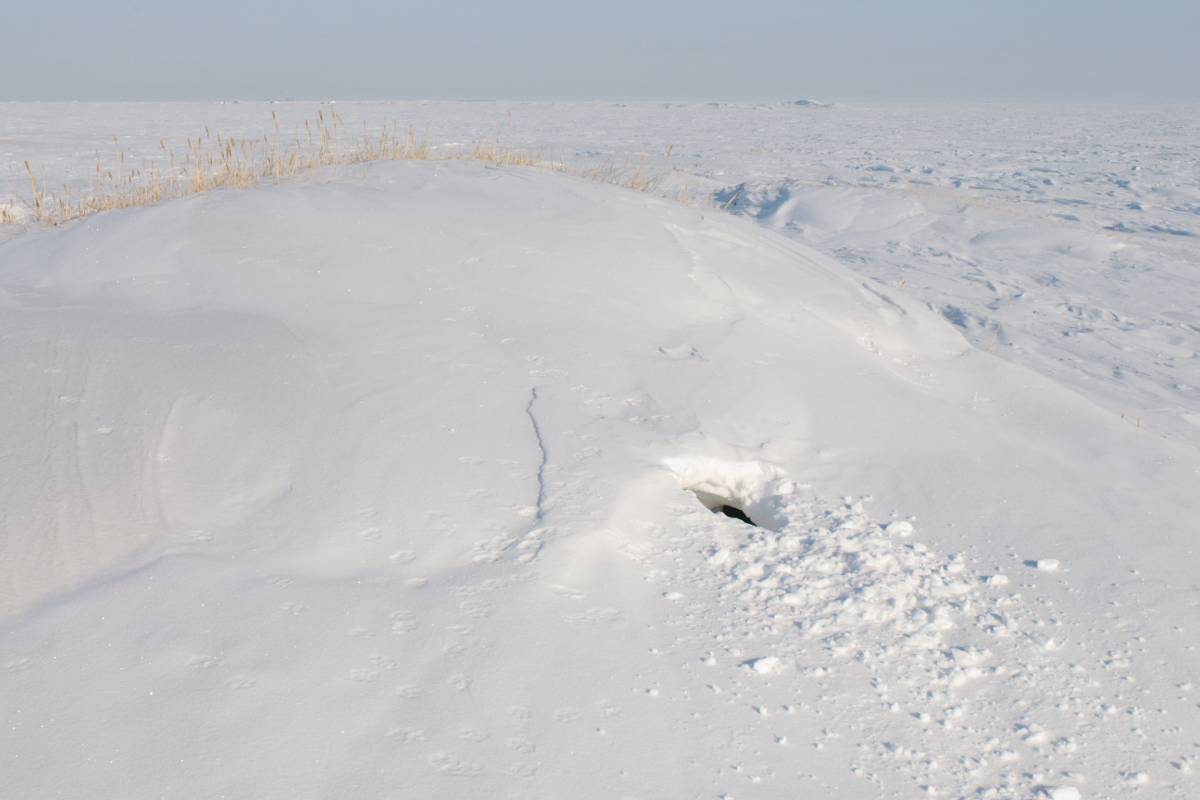
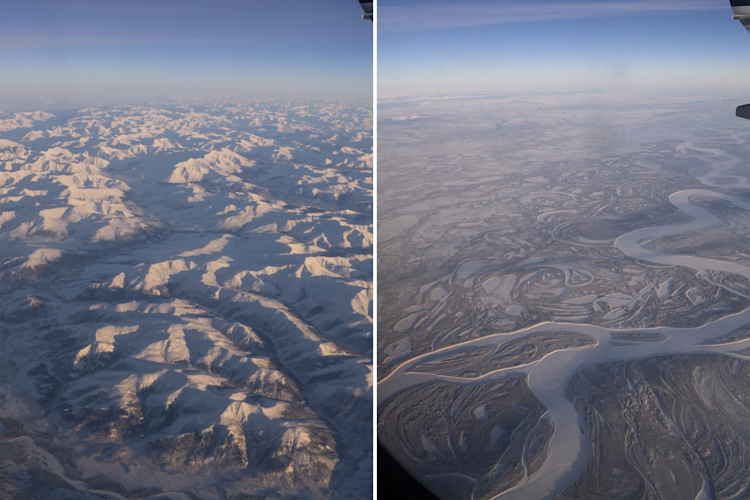
We plan to conduct additional tests with SAR on Svalbard's challenging terrain this spring.

Photo: BJ Kirschhoffer / Polar Bears International

Covid permitting, we plan to conduct additional tests with SAR on Svalbard's challenging terrain this spring.

Q: What makes SAR so promising? How is it different from FLIR?

A: Geoff York: Unlike FLIR, SAR can “see” through clouds and fog, etc., making it much more useful in real-world Arctic conditions. SAR is also able to see through snow, potentially making it useful in situations with similar challenges, such as avalanche rescue scenarios. In addition, SAR has a much wider operating range when it comes to weather than FLIR. It can be operated from a much higher altitude and has the ability to survey a much larger swath, which is particularly helpful in vast landscapes like the Arctic. Aside from its flexibility and more accurate detection rates, another advantage of SAR is that it can be attached to a fixed-wing aircraft, with surveys flown at an altitude that would make them imperceptible to a denning female or her cubs. FLIR, on the other hand, is most effective when based from a helicopter, so there is some risk of sound disturbance when flying over a den.

Q: Polar Bears International’s first tests with SAR took place in Alaska in 2014. Can you tell us about those pilot tests and the findings?

A: BJ Kirschhoffer: In partnership with Brigham Young University, we conducted several pilot flights with SAR on Alaska’s North Slope over known den sites.The landscape in Alaska is vast, flat, and covered in snow, making it very difficult to locate polar bear dens beneath the snow surface. Although the results of these pilot tests were promising, it was hard to determine the effectiveness with limited known den locations to help ground-truth the data. Due to lack of funding we weren’t able to conduct further research at that time. However, we decided to revisit the use of SAR after an analysis of FLIR’s performance revealed that it was missing more than half of all known dens. Polar bears are already under enormous pressure from sea ice loss due to human-caused climate change. Doing all that we can to ensure a safe denning period will make a real difference for the bears. 

A plane on the runway in the Alaskan sunset

Photo: BJ Kirschhoffer / Polar Bears International

We conducted our first tests with SAR on the North Slope of Alaska.

Q: What were the next steps after the pilot flights in Alaska? What progress have you made?

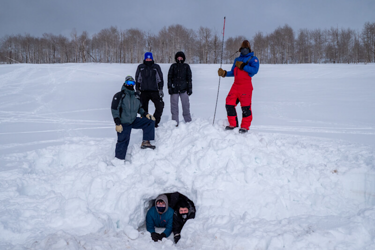
A: BJ Kirschhoffer: Thanks to a generous grant from RBC Tech for Nature and donations from the public in support of the den-detection project, we were able to conduct additional research in the spring of 2021 in Provo, Utah, working with a team of senior students from the engineering and computer science departments at Brigham Young University. For that project, we constructed six artificial dens in the snow and then ran a series of test flights in light aircraft mounted with SAR. The students helped set the optimal bandwidth for the SAR and also helped dig the dens. Some of the dens that we tested were empty; others contained foil simulants made to mimic the size and shape of denning polar bear families nestled under the snow. The tests were highly successful, with SAR successfully detecting both empty dens as well as dens with foil simulants.

Researchers pose by an artificial den constructed for test purposes in Utah

Photo: Kt Miller / Polar Bears International

Brigham Young University researchers pose by one of the artificial dens constructed for test purposes in Utah.

Q: You also conducted tests in Churchill, Manitoba. What did you find?

A: BJ Kirschhoffer: Following discussions with the team, we realized that we needed to fine-tune the ability of SAR to “recognize” the radar signature of polar bears, an important factor in detecting dens occupied by moms and cubs. So, in November of 2021, we worked on honing the signature, or what the radar “sees,” by conducting flights along Western Hudson Bay. The town of Churchill, which is set on the coast, is a known gathering place for polar bears as they wait for freeze-up in the fall. This allowed us to collect data on polar bears while walking or resting on the shore in a place where they are reliably seen. Students from Simon Fraser University helped operate the SAR, and students from Brigham Young University helped hone the radar data and ground-truth the field tests, providing us with valuable data.

Q: That all sounds very exciting. What’s next? 

A: BJ Kirschhoffer: The results from Churchill were promising, so this spring we plan to run some field tests with SAR on two known polar bear den sites in Svalbard. We conduct a maternal den study there every year with remote cameras, and it makes sense to conduct the den-detection tests while we are already there, setting up cameras. 


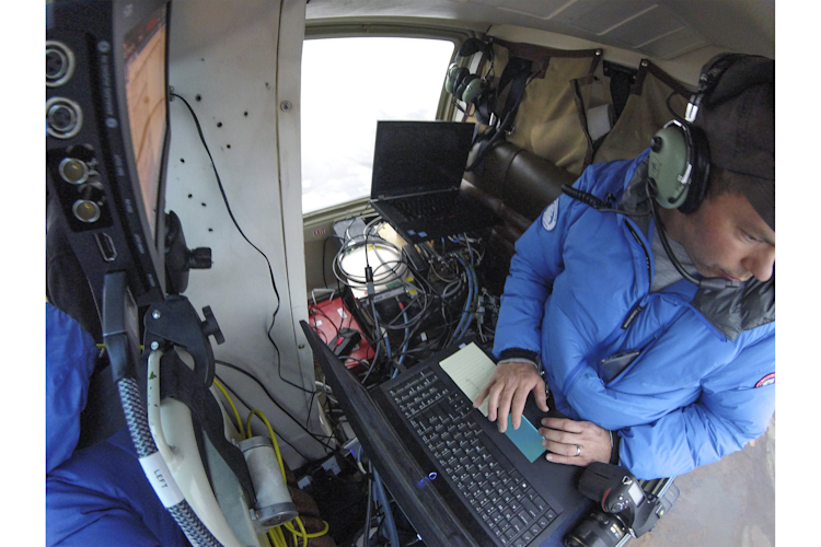
BYU researcher inside a helicopter in Churchill testing SAR

Photo: Kt Miller / Polar Bears International

Configuring radar for an upcoming SAR test in Churchill, 2021.

Q: Any parting thoughts?

A: BJ Kirschhoffer: It’s been a long-term hope of mine that someday we might be able to do this type of innovative technology-based research. Operating in the Arctic is incredibly expensive—especially when it involves aircraft in remote Northern communities—and to have the resources to develop these tools and do this important work is super exciting. We are grateful to everyone who is helping us make this work possible, and ultimately supporting our work to conserve polar bears into the future. 

Thanks to our partners on the SAR den-detection tests: Brigham Young University, Simon Fraser University, and ARTEMIS. Huge thanks, too, to RBC Tech for Nature and individual donors for funding for the SAR study.