BJ Kirschhoffer, our director of field operations, has been working with a team to test the effectiveness of Synthetic Aperture Radar technology, or SAR, to detect polar bear dens hidden under the snow. If successful, the technique could be used by wildlife managers and industry to map—and avoid—den sites.
We caught up with BJ for a Q & A before he heads north to Alaska for more den work.
Tell us about SAR. What is it and how does it work?
The device is very small, but acts like a large antenna. When you attach it to an aircraft and fly over a landscape, it sends out pings and listens to the waves that come back to create a detailed map of what’s below. The whole process happens very fast, as the aircraft flies high overhead.
How accurate is SAR in detecting polar bears under the snow?
We’ve spent two field seasons testing the SAR in Alaska and have learned a lot. Finding the sweet spot for what frequency to use has been challenging. We need to set the resolution high enough to find a polar bear, but low enough to penetrate the snow surface. We recently received results from our last field trial and think we are getting very close.
How so? What did the results show?
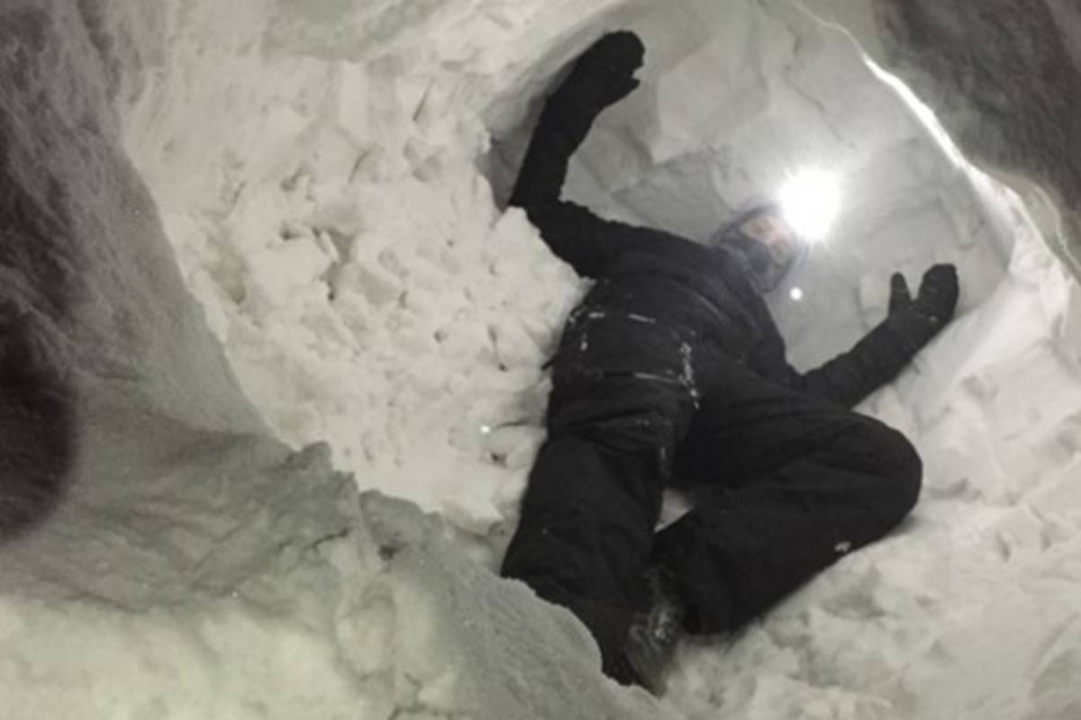
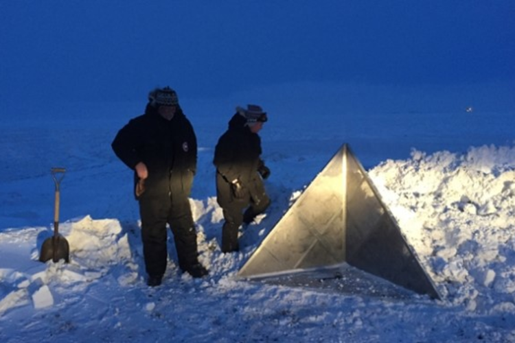
We created two artificial dens under the snow that the SAR was able to find. My field partner, Wes Larsen, and I got inside one to simulate a denning family and we placed radar-reflecting objects in the other.
In addition to our artificial dens, we think the SAR also found an actual den, one originally detected with a Forward Looking Infrared or FLIR device. We hope to ground-truth that one this summer to make sure what we thought was a denning family wasn’t an oil barrel or a big rock—but it looks promising.
If FLIR devices can find dens, why is SAR needed?
Conditions have to be just right for the FLIR to work—and that’s not easy when working in an Arctic winter. For example, the wind can’t be blowing more than six miles per hour, the sun can’t be above the horizon, and it doesn’t work after a big snowfall.
SAR technology doesn’t have the limitations that FLIR does. You can fly at almost any height you want, at any time, and in any weather. Also, the FLIR only covers a narrow range: It’s like looking through a soda straw, whereas SAR covers a wide sweep. SAR has the potential to be more accurate, more flexible, and much faster.
Why are you most excited about SAR?
It’s very cool technology that could revolutionize how we find polar bear dens. As more industry moves into the Arctic, it will be increasingly important to map den sites to avoid disturbances. If the SAR technology works, scientists will be able to quickly and accurately create maps—and that’s exciting stuff!
PBI’s partners in the project include Michigan Tech Research Institute and Brigham Young University.


